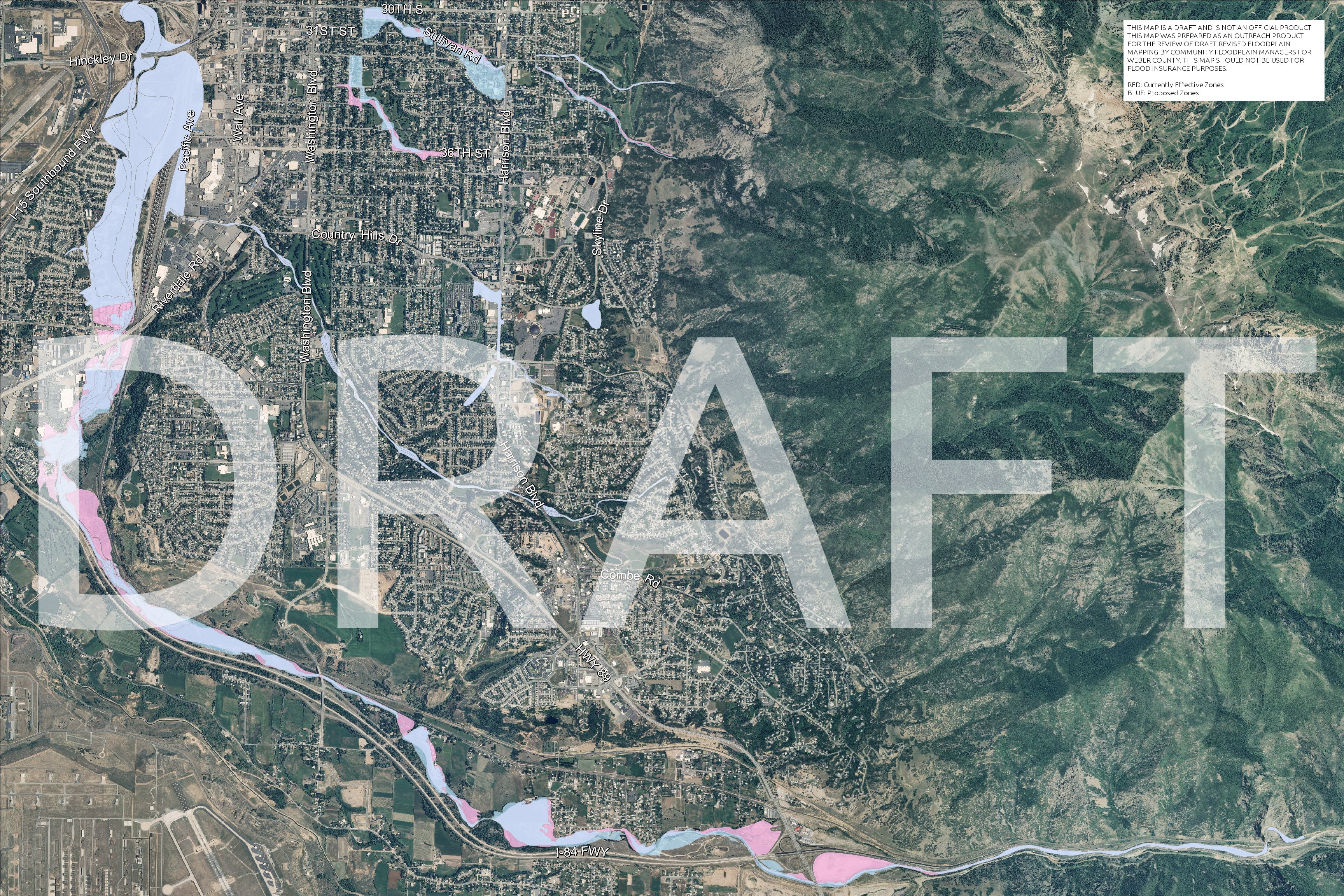
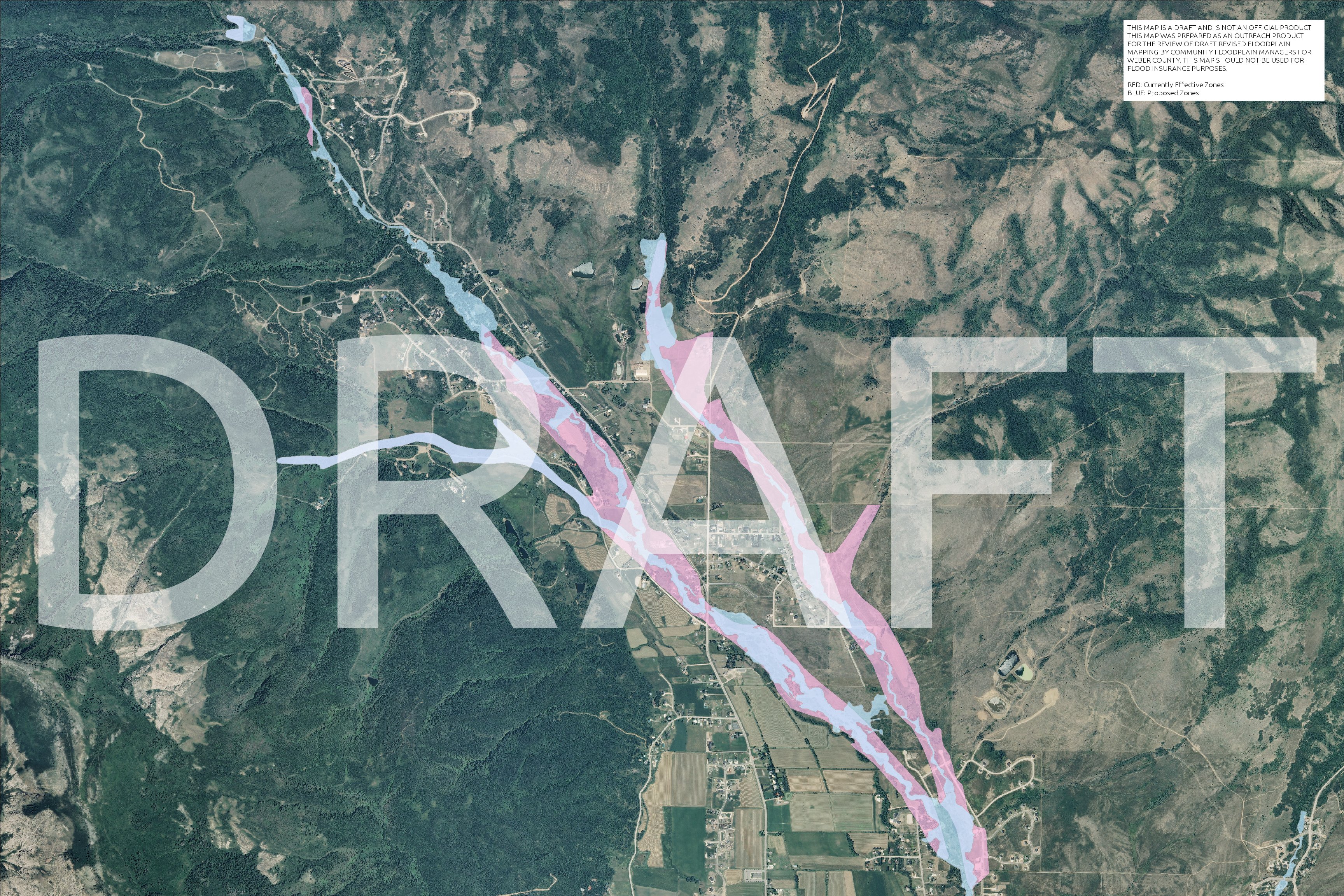
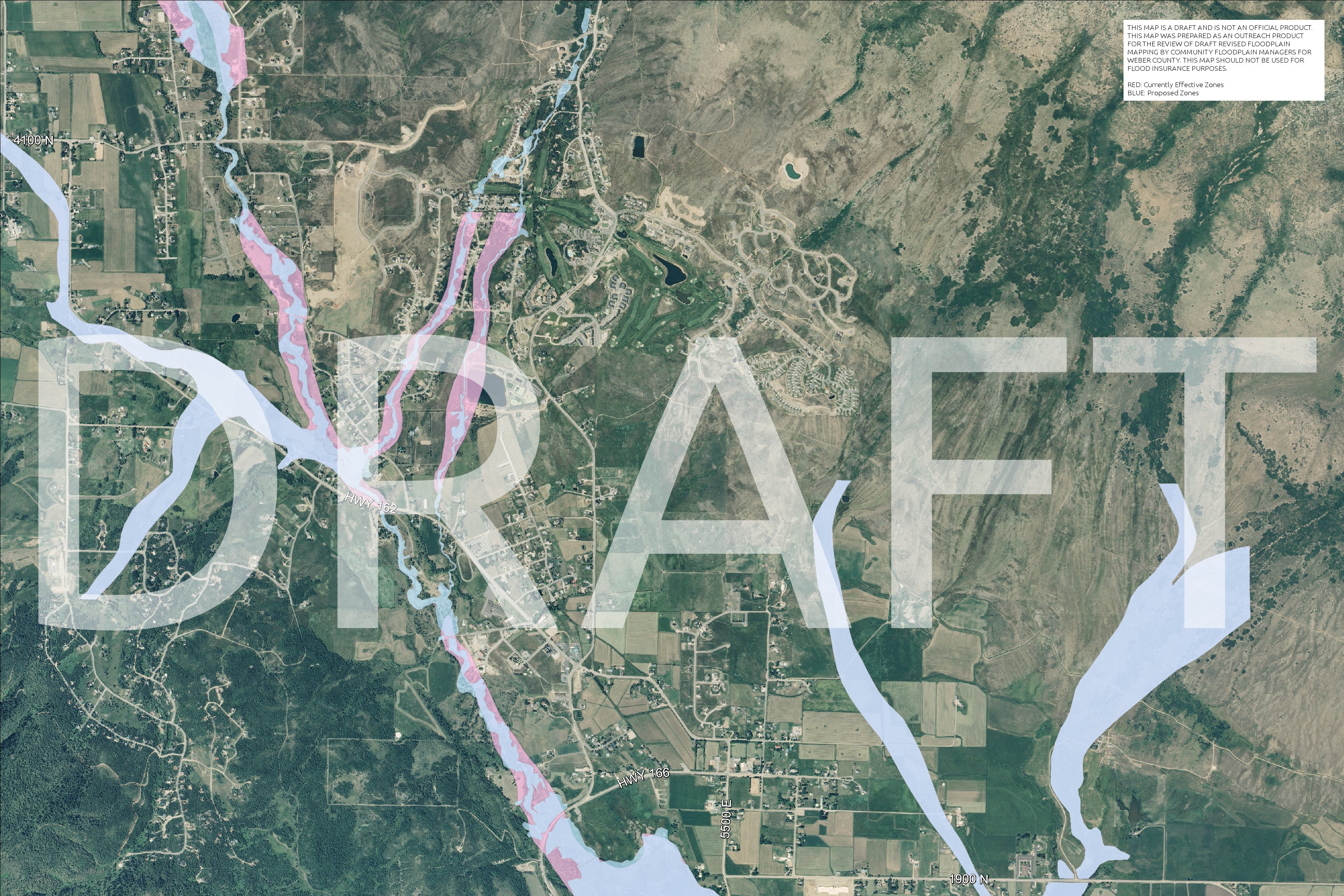
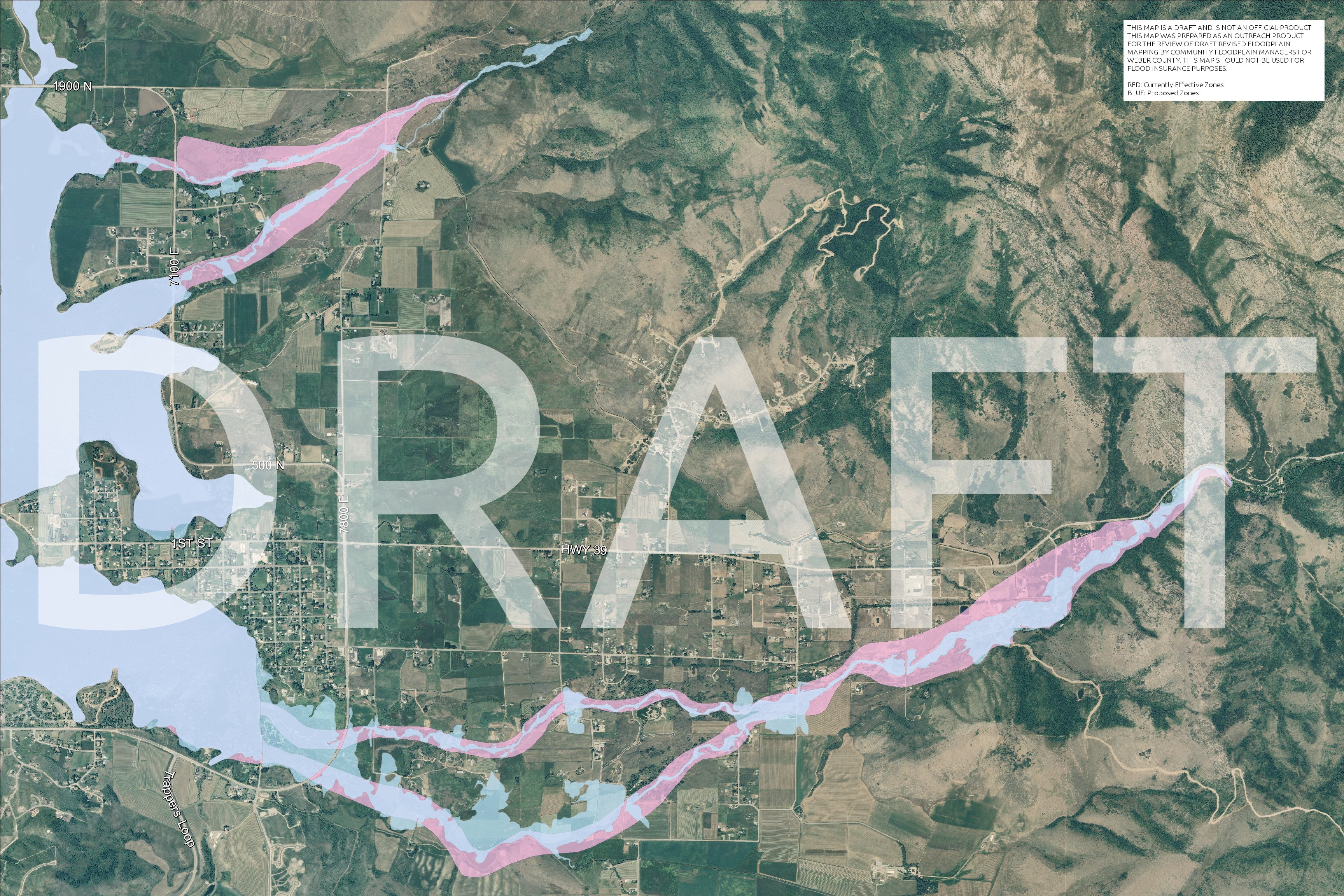
2011 FIRM Map Updates
- 2011-12-06 – Community Consultation Officer (CCO) Meeting
- 2011-12-06 – Public Open House 5:30 pm Commission break-out room
- 2012-04-30 – 90 Day Appeal Ends
- 2014-08-02 - Target LOMR Incorporation Date
- 2014-12-02 - Target Letter of Final Determination
- 2015-06-02 - Target Effective Issuance Date
- 2015-06-03 - Target Revalidation Letter Date
The notices that were mailed out state: "If your property is found to be located within the 100-year floodplain, you will be required to purchase flood insurance." Please know that is directed to federally backed mortgages. If you fully own your property, then there is no federal mandated requirement.
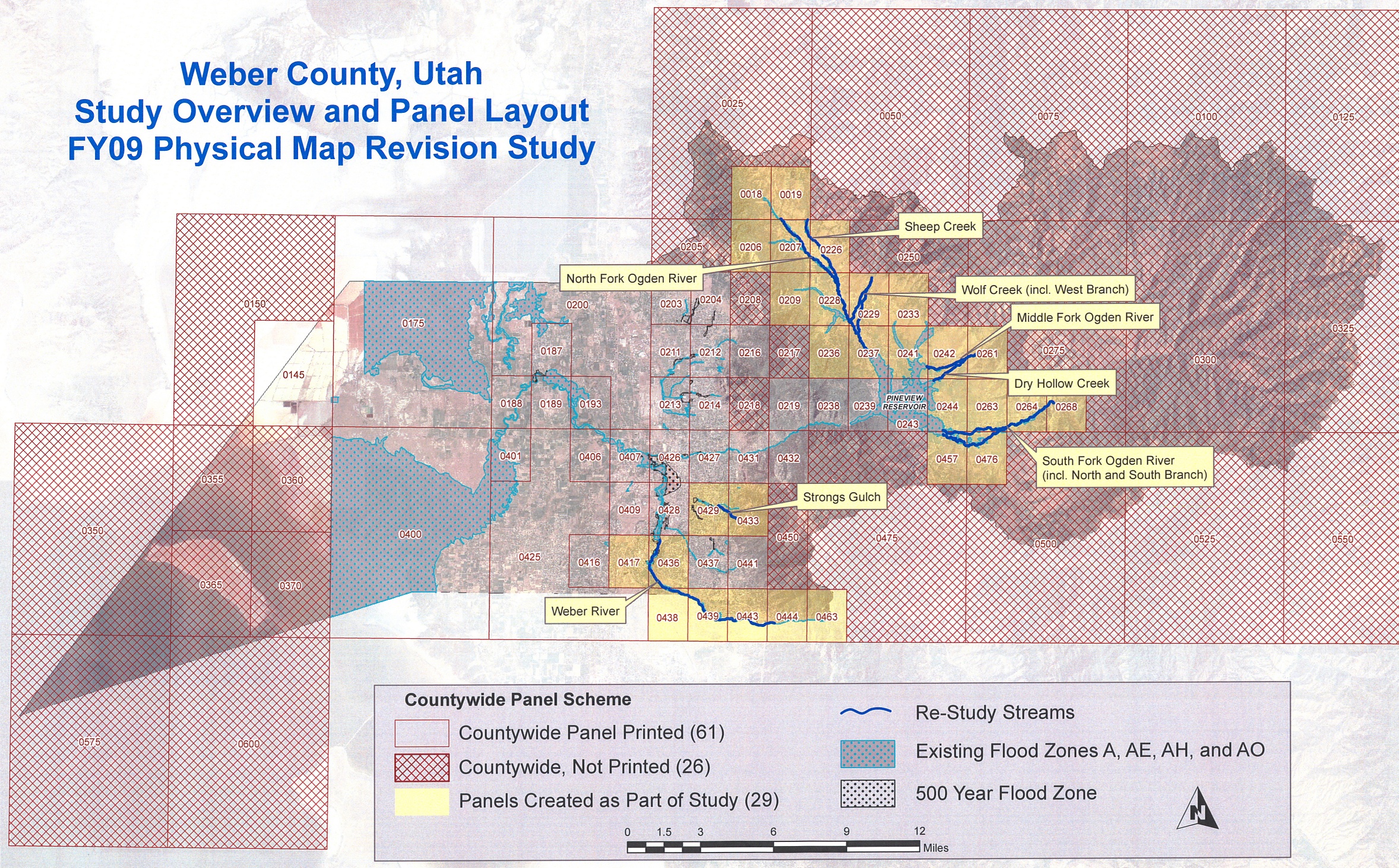
- View approximate changes for the following areas:
Preliminary Firm Panels |
General Information
Ogden Valley Sheet Flow
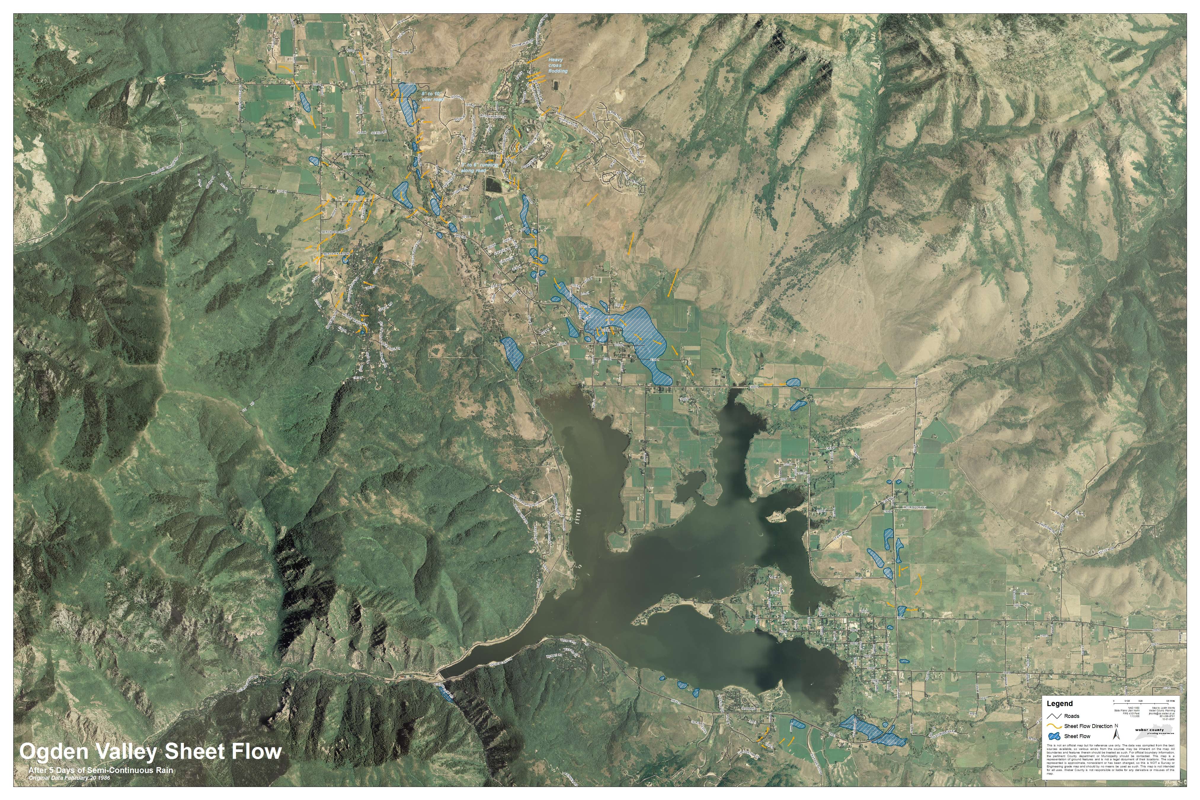 This map was developed from visual observations of sheet flow flooding that occurred on February 20th 1986. The map was created to help assist county staff and the public address potential flood issues. This map is not intended to be all inclusive of flooding that took place on this date. Other areas of the Ogden Valley may have also experienced flooding or have the potential of flooding but were not observed. This map is used in addition to FEMA floodplain maps.
FEMA Related Information
General Flood Hazard Boundary Information
- Weber County participates in the National Flood Insurance Program (NFIP). The program was created by the Federal Emergency Management Agency (FEMA) in an effort to improve public safety, prevent property damage, and protect the natural floodplain environment. Communities that participate in this program agree to manage flood hazard areas by adopting minimum regulatory standards. Weber County has adopted these standards by enacting ordinances which regulate development within Special Flood Hazard Areas (SFHA). For more information on what ordinances have been enacted by Weber County, please contact the Weber County Planning Department or the Weber County Engineering Department. Currently, SFHAs can be viewed on maps called Flood Insurance Rate Maps (FIRMs) published by FEMA.
Flood Insurance Rate Maps (FIRMs)
- The purpose of a FIRM is to show the SFHAs in your community. SFHAs are areas determined to be inundated by a 100 year flood. FIRMs can be viewed or obtained from a variety of sources. You can view and/or download scanned versions of a FIRM at FEMA's web site, or view FIRMs for the Unincorporated Weber County areas at the Weber County Engineering Office (Public Works Department). You can also view an UNOFFICIAL digital version of the FIRM(s) by clicking on the provided link below (please read the disclaimer).
How the NFIP and determined flood areas may affect You
- Currently, all proposed developments in the unincorporated Weber County Areas are reviewed by the Weber County Engineering Department for possible flood hazards. Any structures, fill, or other disturbance within a SFHA requires a floodplain development permit, and in some cases, a elevation certificate as well. Both are available at the Weber County Engineering Office. Mortgage lenders may be required to determine if a property they are financing is located in a 100 year floodplain or a "Zone A" SFHA on a FIRM. With this information, a mortgage lender can require a buyer to obtain flood insurance. Owners should be aware of how their property may be effected by SFHAs or other possible flood hazards in order to improve their safety and protect their property.
- Please be aware that at the time each SFHA was determined, FEMA used the most accurate information available. However, due to limitations in topographic map definition and scale, as well as the placement of fill or other alteration of the land after a FIRM publication, structures or property may be inadvertently or unnecessarily included in a SFHA. For such situations, the Property Owner may apply for a Letter of Map Amendment (LOMA) or a Letter of Map Revision - based on Fill (LOMR-F). For more information please contact the Weber County Engineering Department or visit FEMAs LOMA / LOMR-F Tutorial Series.
- Please Note:
- FEMA does not allow government entities to make flood hazard determinations except as necessary to administer its floodplain ordinances. Weber County Engineering Department will try to be as helpful as possible with any questions. However, Weber County will not make insurance determinations.
Emergency Information Resources
- There are several different methods for emergency information dissemination, including this website. Flooding emergencies are typically neighborhood specific, and our County is rather unique in topography and geometrics. We have found our most useful tools during emergencies are typically face-based, such as community- and faith-based organizations, the Sheriff’s Office, and CERT volunteers. These people have been helpful by going door to door to alert all who may become affected. Information about evacuation routes, shelters, and other pertinent information will be given out at this time and will also be posted on this website.
- We have the ability to send emergency alerts out through NOAA weather. When that system is used, alerts will be issued through the radio stations, television stations, and the national weather emergency alert radio system.
- In the event of a wider area emergency, our CodeRED emergency notification program will be utilized. For those that have a land line, a reverse notification call will be made to those potentially affected. For those that do not have a land line, this link will allow you to register a cell phone number with our Community Notification Enrollment (CNE) to receive the reverse notification call.
- This link below will allow citizens to download the CodeRED Mobile Alert app.
- Depending on the size and nature of the emergency, through our CodeRED program we have the ability to ping the cell phone towers and get information to all cellular phones within range of a certain tower.
- Click here for more information about emergency preparedness: Before, During, and After
- Below are some brochures which may be helpful to you as you assess your family’s needs:
-
- Emergency Preparedness Checklist
- How to Prepare for a Flood
- Your Family Disaster Supplies Kit
- Checklist for People with Mobility Problems
- Your Family Disaster Plan
- Preparing for Disaster for People with Disabilities and other Special Needs
- Helping Children Cope with Disaster
- Food & Water in an Emergency
- Preparación para casos de desastre para personas con discapacidad y otras necesidades especiales
- Cómo ayudar a los niños a confrontar una catástrofe
- Agua y alimentos en una emergencia
FEMA Links
- FEMA
- FEMA Flood Maps - Ordering online
- FEMA NFIP Elevation Certificate and Instructions
- Department of Homeland Security
- National Flood Insurance Program (NFIP)
Disclaimer
- The map shown herein is a digital version of the most current paper Flood Insurance Rate Maps (FIRM) for the Weber County area. This digital version is currently NOT official with or accepted by the Federal Emergency Management Agency (FEMA) or any other jurisdiction, department, entity, business, or individual. Weber County makes no representation regarding the completeness or accuracy of this or other data in databases, links, maps, datasets, or data extraction procedures provided herein.
- Weber County is a Cooperative Technical Partner with FEMA. This digital version of the FIRM(s) is a product of this current partnership. When accepted, this digital version or future revision will be part of a Digital Flood Insurance Rate Map (DFIRM) product. A DFIRM will more easily address maintenance needs as well as restudy needs. A DFIRM will also be designed to allow for the creation of interactive, multi-hazard digital maps.

